You are here

Mapping - Japan

Primary tabs

The Mapping Working Group is focused on enabling situational awareness improving health and human security in Japan.

The mission of the Mapping Working Group is to enable situational awareness improving health and human security in Japan, with a focus on the Health Capacity Zones most impacted following the March 11 earthquake/tsunami, and the failures of damaged nuclear reactors emitting radiation from the Fukushima power plant. 

Working Group email address:  ***@***.***

Members

AlMac99 James Miller Kathy Gilbeaux mdmcdonald

Email address for group

mapping-japan@m.resiliencesystem.org

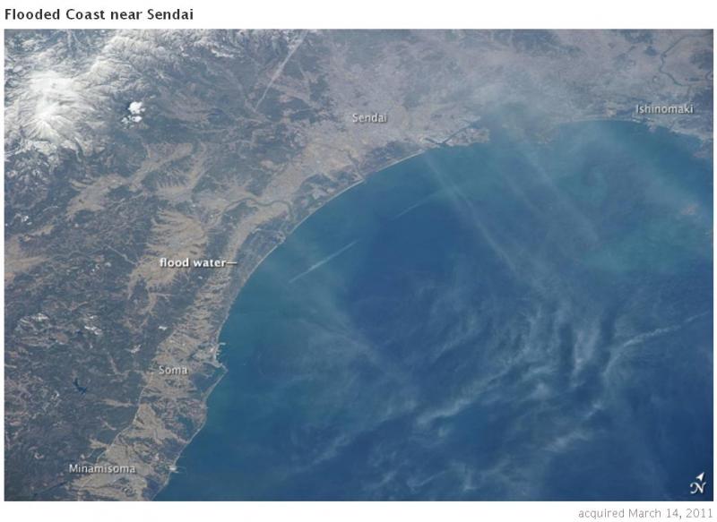
Minamisoma (of Honshu) inundated

Attached is aerial footage showing Minamisoma and surrounding area impact from tsunami.

Aftershocks

Attachment shows locations of aftershocks, how severe, and proximity of nuclear power plants.

Map where people missing

I think EC JRC (from Europe) is a great map showing what numbers of people are missing where the tsunami came ashore.  It has major highways, city names.

Fukushima Nuclear Maps - Stay out - no fly - no people

Attached # 1 is not all that great a map, but it is a starting perspective.

Attached # 2 has not that much more detail, but may be good enough.

Attached # 3 I called "unknown" because it is not obvious from the context if the map is of Fukushima Dai-ichi which has most serious problems, or Fukushima Dai-ni which also has serious nuclear accident issues.

Attached # 4 shows what changed, thanks to comparing images from two satelites, to see what changed one picture to later one.

Alister Macintyre Map Links Collection Mar-20 version 2.2

Attached (if this works) is my latest collection of links to Maps associated with disaster recovery ... Haiti initially, Japan now also included (see approx pages 16-23).

Animated map shows radioactive material's path across Pacific toward California

Austria's Federal Ministry for Science and Research has released this map showing radioactive material from the disaster in Japan moving across the Pacific Ocean toward California.

As The Times' Ralph Vartabedian reported, small amounts of radioactive isotopes from the quake-crippled Japanese nuclear power plant are being blown toward North America. Though they could reach California by Friday, officials said they see no health danger and stressed that any radiation reaching here would be well within safe limits.

Federal officials are monitoring radiation levels in places such as Anaheim, Bakersfield and Eureka.

Read more...

______________________________________________

as submitted by David Hastings

Forecast for Plume's Path Is a Function of Wind and Weather

Alister Macintyre Japan Map Collection

I have added some more to my growing collection of Japan map links.

Various science mapping efforts have begun,[1] such as:

Pages

howdy folks