Animated map shows radioactive material's path across Pacific toward California

Austria's Federal Ministry for Science and Research has released this map showing radioactive material from the disaster in Japan moving across the Pacific Ocean toward California.

As The Times' Ralph Vartabedian reported, small amounts of radioactive isotopes from the quake-crippled Japanese nuclear power plant are being blown toward North America. Though they could reach California by Friday, officials said they see no health danger and stressed that any radiation reaching here would be well within safe limits.

Federal officials are monitoring radiation levels in places such as Anaheim, Bakersfield and Eureka.

Read more...

______________________________________________

as submitted by David Hastings

Forecast for Plume's Path Is a Function of Wind and Weather

Historical Context for Radioactive Particulates Moving from Asia to the US

As as the Lawrence Berkeley National Laboratory wrote last December:

About a third of the airborne lead particles recently collected at two sites in the San Francisco Bay Area came from Asia, a finding that underscores the far-flung impacts of air pollution and heralds a new way to learn more about its journey across vast distances.

In a first-of-its-kind study, scientists from the U.S. Department of Energy's Lawrence Berkeley National Laboratory and the California Air Resources Board tracked variations in the amount of lead transported across the Pacific over time.

It's well known that particles and other aerosols cover long distances through the Earth's atmosphere. But the details of this transport, such as that of the lead particles' 7,000-mile journey from the smokestacks of China to the west coast of North America, are largely unknown.

From 2001:

http://earthobservatory.nasa.gov/IOTD/view.php?id=1352

From 2010:

http://newscenter.lbl.gov/feature-stories/2010/12/01/lead-isotopes-air-pollution/

From 1998:

Jetstream Analysis from SFSU Meteorology


More info at the SFSU Meteorolog page.

No fallout danger to U.S. from Japan-NRC chief

The U.S. Nuclear Regulatory Commission believes there is no radiation danger to U.S. territory from the nuclear reactor disaster Japan, NRC Chairman Gregory Jaczko said on Thursday.

"We don't see any concern for radiation levels that could be harmful here in the the United States or any of the U.S. territories," he told reporters. He said NRC recommended evacuating areas within 50 miles of Japan's stricken reactor as a prudent precaution.

Read more...

Alister Macintyre Japan Map Collection

I have added some more to my growing collection of Japan map links.

Various science mapping efforts have begun,[1] such as:

Obama defends nuclear power, says Hawaii, West Coast safe

WASHINGTON » President Barack Obama is defending nuclear power as an important source of energy in the U.S., even as new questions are raised about its safety following radiation leaks from an earthquake- and tsunami-damaged nuclear plant in Japan.

Obama also told a Pittsburgh TV station that he has been assured that Hawaii and the U.S. West Coast will not be affected by radiation released from the damaged nuclear plant in Japan.

Read more...

Feds move more radiation monitors to West Coast

March 17, 2011

Growing concern by Americans over exposure from damaged nuclear plants in Japan has prompted officials to deploy more radiation monitors in the western United States and Pacific territories, federal environmental regulators say.

Officials with the U.S. Nuclear Regulatory Commission said they do not expect harmful radiation levels to reach anywhere in the U.S. from Japan.

Radioactive Plume Map

Click on the map image above to see the interactive version.

Japan Cell Signal Map


Signal Map is a free resource that allows users to enter the Japanese postal code (as well as US and other countries) into their system and view a map that displays the dead zones (identified by a skull) and the signal strength (identified by th 'bars' symbol).

Overview - Japan Earthquake and Tsunami - March 12, 2011

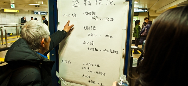
Tokyo Train Information

Updates on delays and cancellations for train lines in Tokio

Tokio Train information March 15th 2011

Friday's earthquake and the looming threat of blackouts have thrown the usually well-oiled Tokyo rail system into disarray. We'll be updating this information as the day goes on.

As of Tuesday, 5.20pm (percentages indicate volume compared to regular service)...

Radiation escaping in Japan

Third unit explodes at damaged nuclear plant

– Radiation spewed today from a crippled nuclear power plant in tsunami-ravaged northeastern Japan in a dramatic escalation of the 4-day-old catastrophe, forcing the government to tell people nearby to stay indoors to avoid exposure.

Hospital List in Miyagi

Sendai City

Aoba area
・Tohoku Uiversity Hospital ER (accept only for the emergency case)
・Tohoku Rousai Hospital (emergency case comes first)
・Sendai Teishin Hospital (as usual)
・Sendai Syakai-Hoken Hospital (as usual)
・Tohoku Kousai Hospital (accept all patients but emergency case comes first)
・Sendai Kousei Hospital (accept all patients but emergency case comes first)
・JR Sendai Hospital (accept only minor injuries)
・Red Cross Miyagi Chaptel, Sendai City Hall(24hr)

Miyagino area

Pages

Subscribe to Japan RSS
howdy folks