You are here
The 2011 off the Pacific coast of Tohoku Earthquake: Crustal Deformation and Fault Model
Primary tabs
Mon, 2011-03-14 04:08 — admin
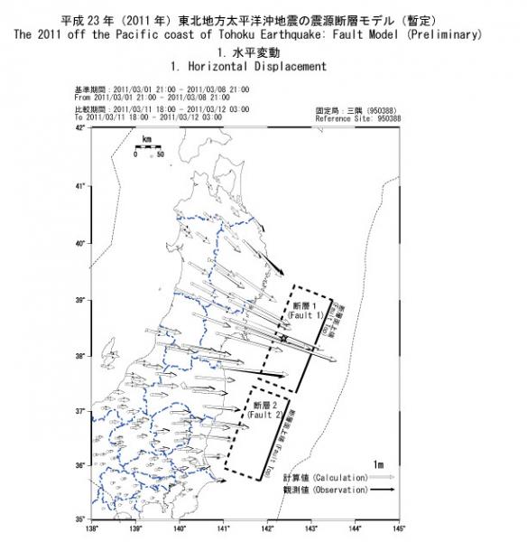
A total major rupture length reaches ~400 km with a fault width of ~80-90 km. (Northern segment: ~200 km long/ Sourthern segment: ~180 km long).
A fault upper edge is at a depth of 10 km.
A reverse fault motion is inferred. Slip amounts of northern segment and southern one are estimated to be ~28 m and ~6 m, respectively.
A total moment magnitude is 8.8. (Northern segment: Mw8.7 / Southern segment: Mw8.2)
A mega thrust earthquake with a moment magnitude 9.0 (JMA) occurred in Japan on March 11, 2011 (JST). The Geospacial Information Authority of Japan (GIS) constructed a fault model using coseismic surface displacement data observed by the GPS Earth Observation Network System (GEONET).
A preliminary fault model which consists of two rectangular faults with a uniform slip in an elastic half-space shows that
For more information, visit: GSI Japan


Recent Comments