You are here

Emergency Management

Disaster Preparedness Tokyo

Photo of the disaster guide from the Tokyo Metropolitan Government.Image: Photo of the disaster guide from the Tokyo Metropolitan Government.

metro.tokyo.jp

The Tokyo Metropolitan Government has compiled a manual called “Disaster Preparedness Tokyo” (Tokyo Bousai*) to help households get fully prepared for an earthquake directly hitting Tokyo and other various disasters.

“Disaster Preparedness Tokyo” is tailored to the various local features of Tokyo, its urban structure, and the lifestyles of its residents, and contains easy-to-understand information on how to prepare for and respond to a disaster.This information will be useful now and in the event of an emergency.

(VIEW SITE)*

*Guide PDFs are available for download on the site.

Country / Region Tags: 
Problem, Solution, SitRep, or ?: 

Japan: Evacuation warning as Sakurajima Volcano near nuclear reactor ready to erupt

Sakurajima erupting, as seen from Higashikorimoto, Japan, on 18 August 2013(Kagoshima Local Meteorological Observatory)

Image: Sakurajima erupting, as seen from Higashikorimoto, Japan, on 18 August 2013(Kagoshima Local Meteorological Observatory)

ibtimes.co.uk - August 16th, 2015

People living near Sakurajima Volcano, 31 miles from Sendai nuclear plant, have been told to evacuate the area after a government alert was raised to the second highest level. More than 800 tremors have been detected from the volcano, according to the Kagoshima Local Meteorological Observatory.

Around 77 residents were advised to evacuate the area, and 24 had done so by 3.50pm (local time) on 15 August, the Fire and Disaster Management Agency said in a statement.

(VIEW COMPLETE ARTICLE)

Country / Region Tags: 
Problem, Solution, SitRep, or ?: 

Volcanic activity slows at Sakurajima but alert remains in force

Volcanic fumes rise from a crater near Minamidake peak on Mount Sakurajima at 4:57 p.m. on Saturday. | KYODO

Image: Volcanic fumes rise from a crater near Minamidake peak on Mount Sakurajima at 4:57 p.m. on Saturday. | KYODO

japantimes.co.jp - August 17th, 2015

Volcanic activity at Mount Sakurajima in Kagoshima Prefecture has quieted down after intensifying Saturday morning, but the Meteorological Agency said Monday it will remain on alert for signs of a major eruption.

Tectonic movements indicating swelling of the mountain has also slowed, the agency said. It believes the rise of magma from an underground chamber has subsided for now.

(VIEW COMPLETE ARTICLE)

Country / Region Tags: 
Problem, Solution, SitRep, or ?: 

Typhoon Neoguri - Flooding in Nago, Okinawa


Twitter - @M_Ryuki0529 - https://twitter.com/M_Ryuki0529/status/486648262749732865/photo/1

weather.com - July 9, 2014

In Okinawa, heavy rainfall triggered flash flooding, prompting the Japanese Meteorological Society to reissue an "emergency warning" for landslides and damaging floods for the prefecture, having downgraded it earlier after the typhoon's eye had moved north. The city of Nago on Okinawa Island reported 17.24 inches (438.0 mm) of rain between 9:10 a.m. Tuesday and 9:10 a.m. Wednesday local time.

A Twitter user in Nago posted photos of floodwaters swamping the city of 60,000 Wednesday morning, warning residents of his or her native Miyazaki Prefecture that this was coming their way.

http://www.weather.com/news/weather-hurricanes/typhoon-neoguri-japan-okinawa-flood-threat-20140709

Country / Region Tags: 
Problem, Solution, SitRep, or ?: 

Japan Issues Highest Alert Over Typhoon Neoguri


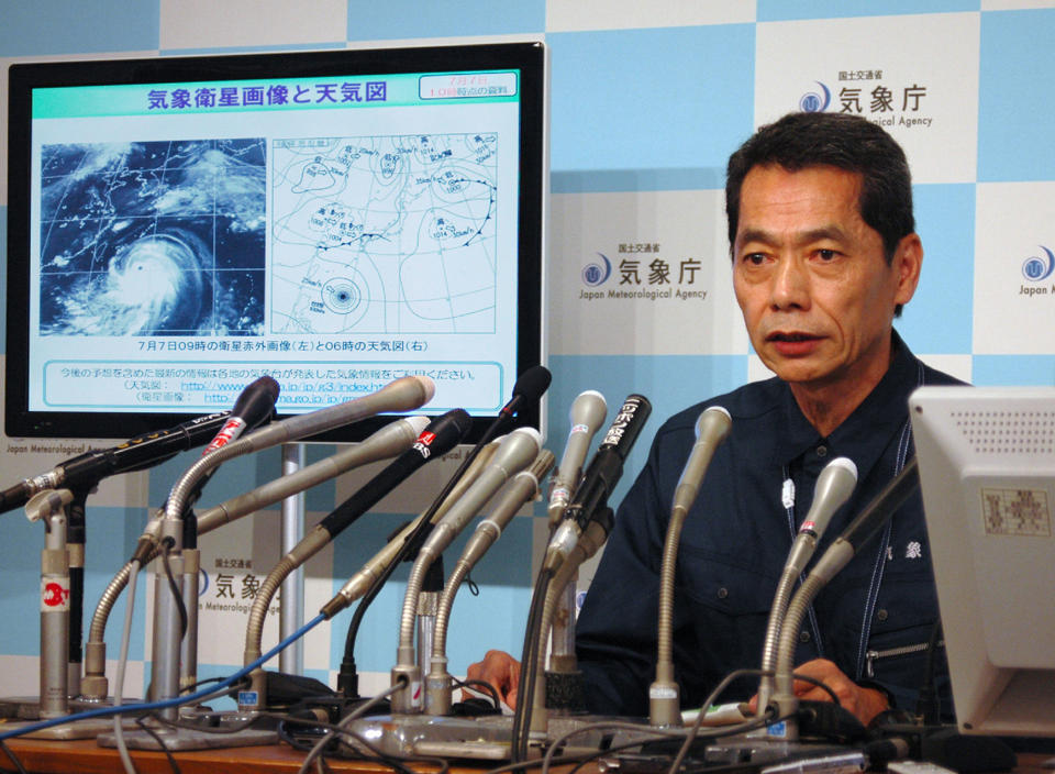
Japanese meteorologist Satoshi Ebihara answers questions during a press conference in Tokyo, on July 7, 2014
(AFP Photo/)

news.yahoo.com - AFP - by Shigemi Sato - July 7, 2014

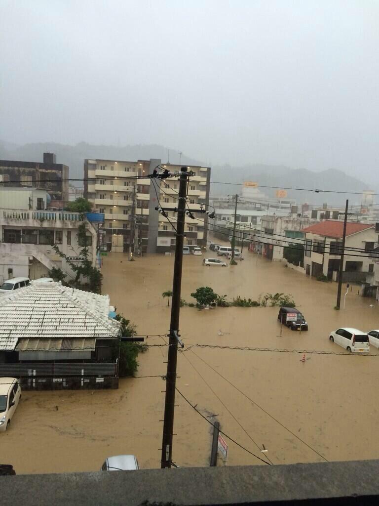
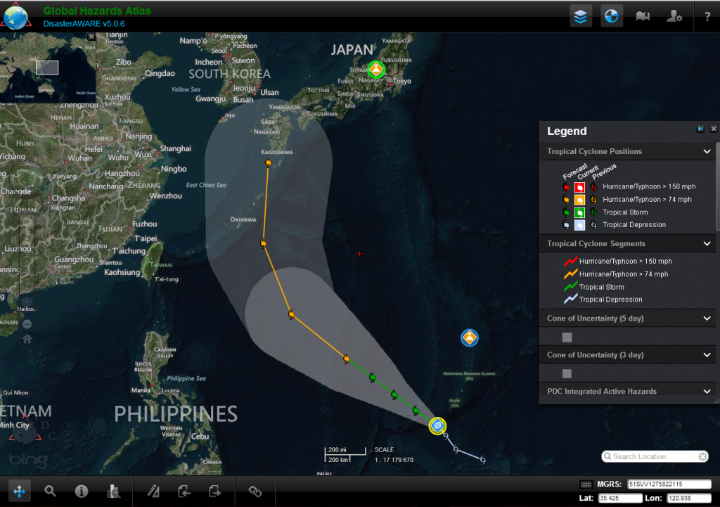
Japan was bracing Tuesday for one of its worst storms in over a decade as typhoon Neoguri barreled towards the southern Okinawa island chain, with 55,000 people urged to evacuate as the weather agency issued its highest alert.

The top-level warning means a threat to life, as well as the risk of massive damage from torrential rains and gusts of up to 250 kilometres (155 miles) per hour. . .

. . . Waves could reach as high as 14 metres (45 feet), a weather agency official said in a warning that was likely to revive memories of Japan's quake-tsunami disaster in 2011.

(READ COMPLETE ARTICLE)

Country / Region Tags: 
Problem, Solution, SitRep, or ?: 

GDACS Red Alert - Tropical Cyclone NEOGURI-14 in Japan


PDC Global Hazards Atlas displaying PDC Integrated Active Hazards with Tropical Cyclone Positions and Segments and Cone of Uncertainty (3 and 5 day) layers.  http://www.pdc.org/weather/

gdacs.org - July 4, 2014

Tropical Cyclone NEOGURI-14 can have a high humanitarian impact based on the Maximum sustained wind speed and the affected population and their vulnerability.

Updated: this report is based on advisory number 9.

  • Tropical Cyclone Hurricane/Typhoon > 74 mph (maximum wind speed of 259 km/h)
  • from 04/07/2014 06:00 UTC to 05/07/2014 00:00 UTC
  • Population affected by Category 1 (120 km/h) wind speeds or higher is 7.4 million

(CLICK HERE FOR ADDITIONAL INFORMATION)

CLICK HERE FOR ADDITIONAL INFORMATION FROM THE JOINT TYPHOON WARNING CENTER (JTWC)

CLICK HERE - GDACS Tropical Cyclones - Joint Research Centre

Country / Region Tags: 
Problem, Solution, SitRep, or ?: 

Pages

Subscribe to Emergency Management
howdy folks
Page loaded in 0.675 seconds.